Showing posts with label Hiking. Show all posts

Monday, May 9, 2016

Arches: Red Rock Wonderland

From Spanish Trail RV Park, Moab, Utah     Our second day in Moab started with an unwelcome steady rain which threatened to thwart our plan to tour Arches National Park. But by 9 a.m. the rain stopped and sunshine could be seen in the distance. Our group decided to meet in Arches Visitor Center at 9:45.

Another selfie
All eight of us, Pam, Ernie, Penny, Bob, Joyce, Charlie, Wayne and I watched a short movie at the visitors center and were ready to explore Arches by 11 a.m.

Joyce, Charlie, Pam, Wayne, me, Penny and Bob seated for the movie. A kind stranger took the picture. Ernie was MIA. 

A bit "like herding cats," as Bob put it, our group of eight, divided into three vehicles, finally got back to the parking lot, loaded and pulled away from the visitors center. We wound around the first steeply ascending curve and looked back down onto the line of visitors coming through the entrance station.

Looking downhill we see the ever growing line of visitors.
Moab is a short distance down the center highway. 

Arches National Park is beautiful. Both cameras, my point-and-shoot and the cellphone, one in each hand, clicked away as we followed the others up, up and through the majestic red rock.

Bob and Penny lead the way through Courthouse Towers.
Formations called Three Gossips, The Organ and Tower of Babel lie ahead. 

The Organ
Arches was making a good first impression. We "oohed and awwed" as we passed the Petrified Dunes viewpoint and notable formations beyond. Our first official stop, however, was to see Balanced Rock where the eight of us explored the base like a troop of Scouts, pausing for every opportunity to get that "very best" photo.

Up the short walkway to Balanced Rock. The weather was surely cooperating now. Shirt sleeves or light jacket weather.
Joyce, Penny and Pam lead, followed by Ernie and Bob. Charlie and Wayne pull up the rear. 

Pam took this group photo with the giant Balanced Rock in the background. 

My favorite "nature" photo at this stop was not of rocks at all. 

The ride continued and we wound around Panorama Point and then left at the split in the road. We passed Salt Valley Overlook and Firey Furnace on our way to Devils Garden Campground where we stopped at a group picnic area. Like Canyonlands, Arches doesn't have eateries but this time we had lunch enough to feed a small army. The picnic tables were for reserved day use but all were empty so we selected on in a nice sunny location, feasted and reloaded quickly.

Part of our lunch gang... Left to right, Ernie, Penny, Bob, Wayne and Pam. Charlie and Joyce are somewhere....

Landscape Arch in Devils Garden was next. This area is was just around the bend from where we ate lunch. A close up view of Landscape Arch would require a near 3 mile hike -- 1.6 each way. I jumped out of the truck to start the hike with the others while Wayne searched for a parking space.


That's me inside a sandy slot canyon. Joyce was the camerawoman.

Looking down onto the trail with snow capped mountains in the far distance. 

About a half mile into the hike, Wayne caught up with Joyce, Charlie and me as we lagged behind Penny, Bob, Pam and Ernie -- the serious hikers among us.

Wayne dressed today for cooler weather. Here's he's come out of his sweatshirt in just his undershirt. 

Time mixed with weather is the creator of these arches as old ones collapse and news ones are created. The walk was beautiful, despite the crowds. I can't imagine what these National Parks are like during the summer season. The National Park brochure reports more than 2,000 arches are cataloged here -- ranging in size from 3 foot to the longest, Landscape Arch at about 300 feet.

One of many small, unidentified arches. 

Joyce and Charlie went on ahead of Wayne and me. The thought of Lexie and Ozzie in the truck, along with the crowded trail, dust, hills and warm sun took their toll on Wayne and me. We decided against continuing to the destination Landscape Arch and turned back.

Another dead tree photo opportunity. 

The vistas and paths through the beautiful red rocks satisfied Wayne and me.  We saw Tunnel Arch along our abbreviated walk. The others hiked on to Landscape Arch and later Joyce told me we were really close at the point where Wayne and I turned back. She went on to say the she thought the walk itself was just as thrilling as seeing Landscape Arch.


Thank you, Pam, for providing your excellent photo of Landscape Arch. 

The truck was still cool when we got back to it. The outside temperature was in the 60's. Just down the road, another arch caught my eye. Wayne stopped the truck and I scurried over an embankment and up a short trail to snap a closeup of Skyline Arch.

Skyline Arch

By the time we saw the sign for Sand Dune Arch and parked the truck, the six others had finished the hike to Landscape Arch and caught up with us. Our group antics required more pictures.

Seems to me, this should be called "kissing arch" because of the placement of the two overhead rock formations.

The trail to Sand Dune Arch is short, flat and easy. It becomes quite narrow in places but opens wide here. The trail does go on past the arch for a little way before closing almost completely and becoming impassable. The sand is deep here inside the canyon and walking is difficult in some places.


The couple on the left of this photo were trying to get a photograph.
Our group, (L to R), Joyce, Charlie, Pam, Bob, Ernie and Penny, photo bombed the couple's effort, I think. 

Parts of Sand Dune Arch have fallen and more activity is expected. In this warning sign, a break-off just two months ago is shown. Our group lives dangerously, though and all but Wayne and I insisted on standing under the arch. 

A bit more Tom-foolery in the Sand Dune Arch slot. That's Penny, Pam and me.
Joyce, Ever Ready as we call her, the usual explorer, opted out of this bit of rock climbing. 

Rock climbing
Finally we left Sand Dune Arch. With so many intriguing names for the rock formations, I couldn't resist naming the next one myself. We caught a glimpse of it on our way to Landscape Rock.  I remembered to snap a picture as we headed back.


The final stop in Arches would be to get a distant view of Delicate Arch. I had hoped to see it from a closer vantage point, but this will do for this trip. It might be too warm to leave the pups in the truck and the strenuous hike to reach the arch wasn't appealing to any of us at this time of afternoon anyway.

Delicate Arch 
It's quite possible that Wayne and I will return to Arches (like Canyonlands) and the town of Moab. There are several points of interest in the area that we haven't seen or explored. As I mentioned in the previous post, a large rally forced our visit to be shorter than we had hoped. Meanwhile, I'm thankful we had this time together here.

Around 5 o'clock, our group gathered for happy hour at Bob and Penny's campsite before breaking up for the evening. That's their beautiful Entegra Anthem coach in the background.

Bob, Joyce, Charlie and Mike, another campground neighbor. 

Mike, his wife (whose name I don't remember) and Penny, holding her dogs


Penny, her dogs and Wayne 


Pam and Ernie 
With dinnertime drawing near, Joyce, Charlie, Wayne and I were in the mood for Thai food so we were first to break up tonight's happy hour. We found a really good place in downtown Moab called Sing Ha Thai Cuisine. The entry was a bit unusual, a shared foyer with a barbershop and then through the door, the place looked more like a storefront than a restaurant. 


Restaurant counter

But inside, the tables were nicely arranged, the mood was authentic and the food was wonderful.


Appetizers


My dinner 

Wayne's dinner
We will leave Moab after just three nights. Pam and Ernie will go to Park City, Utah, while Joyce and Charlie visit Capitol Reef. Wayne and I will travel a short distance east into Grand Junction, Colorado. We are looking forward to a long awaited visit with Ozzie's foster mom, who we haven't seen since his adoption in September 2011. We will catch up with the others in a few days at Park City.

Tuesday, April 26, 2016

Paria Canyon and The Toadstools

From Wahweap Campground on Lake Powell, Page, Arizona    We were near the end of our two week stay at Lake Powell and just couldn't catch a weather break so we must proceed through rain and wind and hail.... well, maybe not hail.

Long before we reached Lake Powell, I saw pictures of Paria Canyon on Amazing Geologist's Facebook page. I swore we'd find Paria Canyon and I looked for it... to no avail. Leave it to my friend Joyce, affectionately called "Ever Ready," to locate it. A gloomy day when Pam, Ernie, Wayne and I were "shut-ins" Joyce and Charlie went exploring... and they found Paria Canyon.

So on Wednesday, April 27th, two days before departing Lake Powell, Pam, Ernie, Joyce, Wayne and I loaded into two vehicles and returned to the place Joyce and Charlie found the day before. Charlie stayed home to rest after a toxic Mexican dinner the previous evening.

Ernie, Pam and Joyce in the red truck leaving Wahweap on U.S. 89
Wayne, Lexie, Ozzie and I follow in Big Whitey.
What we see today is part of the Grand Staircase-Escalante National Monument. This whole area is cared for by the U.S. Department of the Interior Bureau of Land Management. From Wahweap, we traveled northwest on US 89 into Utah -- through Big Water into the Rimrocks area beyond Cottonwood Road toward Kanab.

Before Paria Canyon though, we made a hiking stop at Toadstools. Distance to the first toadstool is a bit less than a mile from the parking area and is relatively easy.


The cliff near the Toadstool parking area gave a glimpse of what was to come. Indeed this is beautiful country.


We gathered in front of the Grand Staircase-Escalante National Monument sign for our group snapshot before the hike. I will mostly let pictures tell the story from there.

A Selfie Stick moment!  Joyce, Wayne and me in front. Ernie and Pam behind.

Joyce leads the troops. 

Pretty stuff to see along the walk. 

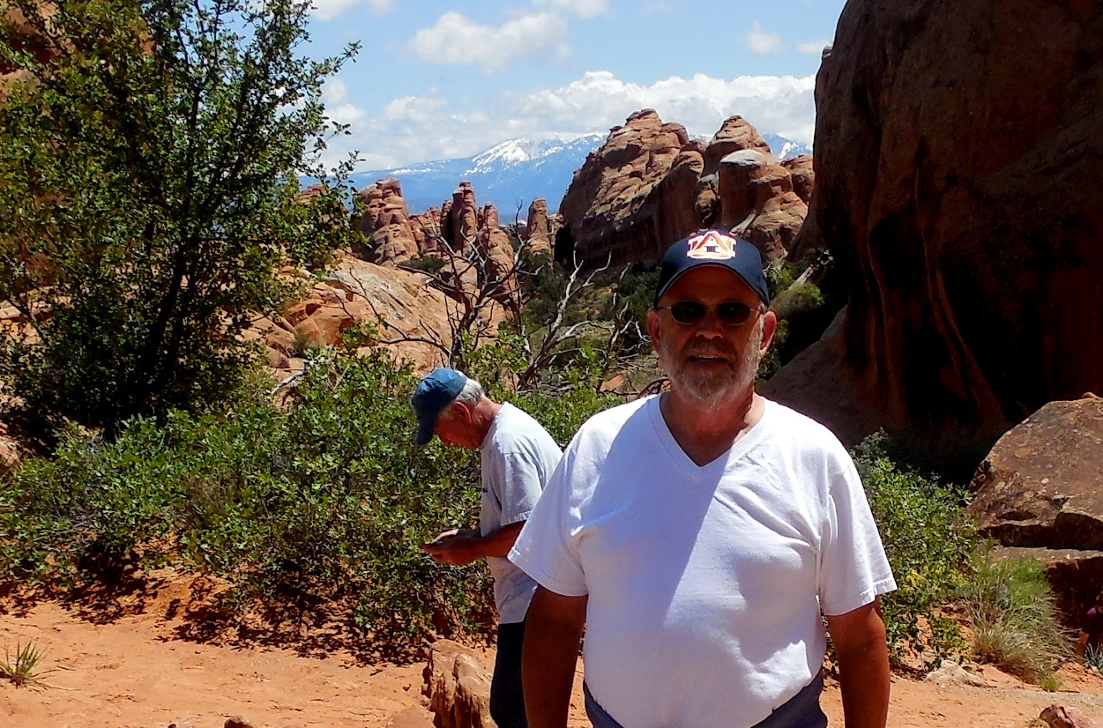
Wayne, the great explorer.  

That's Ernie climbing along the trail
We reached an area referred to on the sign as a "trail obstacle" -- a narrow path across a ravine of maybe 8 feet deep. In the picture below, Joyce went first (blue jacket) and encouraged us on.  Pam has a height fear and I thought she might turn back but she did not.


Steady as you go there, Pam. Ernie reassures her from behind.
We reached the area of the toadstools and we surely were not disappointed. The smooth slickrock and sandstone made for strange landscape. A few stray raindrops fell but did not hinder our exploration or cause a risk of flood (of which we remained mindful).

Among the red toadstools

Wayne surveys the depths below.

How bright the wildflowers are on a colorless background.

More selfies in the midst of the strange landscape 

From this distance, it's easy to see the enormity of these Toadstools

Wayne and me.

More selfie practice. Strange facial expressions help selfie stick operations.

Joyce and me. 

Joyce, me and Pam, L to R. 

More wildflowers. All are especially beautiful in this barren place. 
It was still well before noon when we finished our Toadstools hike and returned to the parking lot. Lexie and Ozzie took a short pee-pee walk before we headed off to the illusive and colorful Paria Canyon that Joyce is sure she and Charlie found the day prior.


We reached Paria River Valley Road in the two trucks, Joyce, Pam and Ernie in one, us and the dogs in the other.  These are the markers where the road intersects with Highway 89.


The road into Paria Canyon.
There is NO WAY any vehicle will exceed the 45 mph speed limit along this deep rutted road
The road decends into a colorful wavy valley. It is breathtakingly beautiful. Wayne stopped the truck and I jumped out for photographs every few dozen yards.


To give perspective to the enormity of Paria Canyon, notice how small Ernie's truck, ahead of us, looks in these pictures.


This road was about 6 miles long, and became steep and twisted crossing hills and valleys. The cliffs surrounding us were multi-colored bands -- alternating purple, white, grey, blue and red.


We reached what I believe is the very same section of Paria Mountains I'd seen on Amazing Geologist's Facebook page months earlier.  Surprisingly, the Bureau of Land Management had placed a couple of picnic tables near the base of the mountain. We spread our picnics out but the breeze became so cool, Wayne and I gathered our food and ran back to the truck to finish eating.


.
There had been a couple of wooden buildings left from movies (The Outlaw Josey Wales among them) filmed here, but they were burned by vandals a few years ago. Now there's nothing except a small cemetery to show any human has ever inhabited this land.


Two people are standing among the colored stripes, near the bottom, just to the right of the center of this picture


There are many possible hikes starting from this area, including the route to Starlight Canyon, however we did not see the trailhead, nor did we come prepared to take a second hike.

Beginning in 1870, settlers built houses and farmed the land between the crumbly red hills and the water of the Paria River. They worked hard and raised most of what was needed to feed their families.  The town, called Pahreah, thrived and reached 130 inhabitants before the floods of 1883 and 1884 began forcing the families away. By the 1930's only a handful of farm famlies spent only summers in what became the ghost town of Pahreah.


Not many records exist from the Pahreah's heyday. Much of what historians know about these people in this strange land has been recorded from decendants of the pioneers who lived here in the early 1920's.

We took a few minutes to walk among the graves at Pahreah Cemetery. This is a sad and forlorne place. I can't imagine how or why the settlers thought it would be a good place to live. It certainly is beautiful. You can't eat beauty though.

View of the colorful surroundings from Pahreah Cemetery
Pahreah Cemetery entrance and iron perimeter gate


Ernie, Wayne and Pam walking in the cemetery. 


We made our way out of the valley and back to Wahweap, happy to have found Paria Canyon and the history hidden here.  Charlie had mostly recovered from Montezuma's revenge when we returned.